Lumberman’s Monument
5401 Monument Road, Oscoda, MI 48750
(989) 362-8961
Tucked away in a remote part of northern Michigan in the Huron National Forest is the state’s monument to the people and places of Michigan’s lumberjack era.
The actual Lumberman’s Monument statue is 14 feet tall, is made out of bronze, and was erected in 1931. It stands on a high bank overlooking the Au Sable River.
This area used to be timber country. Lumberman worked the land, cutting down trees, rolling them down the bluff, and into the river. Then, they would float the logs down the river to sawmills where they would be cut into boards for building.
There is more than just a statue at this stop on the Au Sable River Road National Scenic Byway to help visitors honor and remember the lumberman of Michigan’s past, though.
Where is Lumberman’s Monument?
5401 Monument Road, Oscoda, MI 48750
Lumberman’s Monument is located in Michigan’s Lower Peninsula at the center of River Road National Scenic Byway. It is just 15 miles from the shores of Lake Huron. The communities of Tawas, Hale, and Oscoda are nearby.

Lumberman’s Monument Visitor Center
This is also where you’ll find the Visitor Center, a scenic river overlook with an observation deck, and hiking trails.
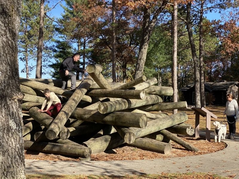
The visitor center has put together interactive experiences and displays to help visitors learn about the lumberjack life.
At one stop, kids and adults alike are encouraged to climb through a log jam.
You might also use a peavey (a tool designed to easily roll and position logs), cut a wooden cookie with a cross-cut saw, and watch videos while you’re at the Lumberman’s Monument Visitor Center
The Lumberman’s Monument Visitor Center is the only visitor center in the Huron-Manistee National Forests.
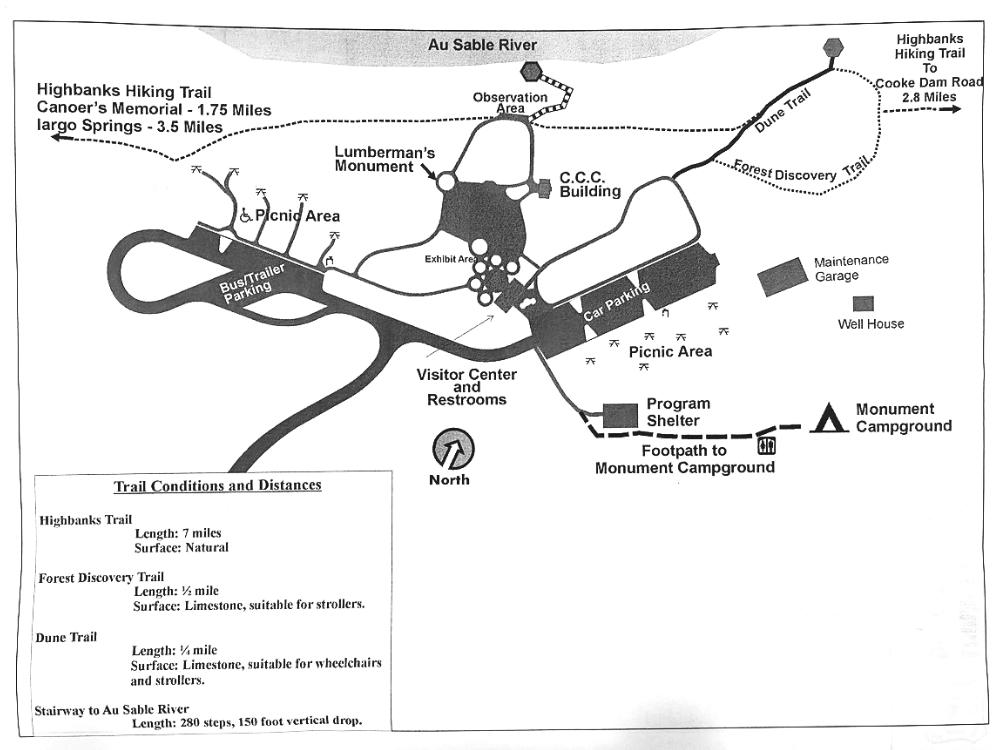
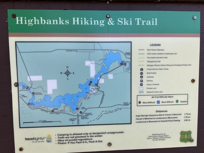
Map of Lumberman’s Monument Visitor
Lumberman’s Monument Visitor Center Hours
Hours for the season:
• Open daily, May 1 – October 24, including weekends, from 10 am to 5 p.m.
• Grounds are open year-round from 6 am – 10 pm.
Parking is available and there is no fee to park or visit Lumberman’s Monument or the visitor center.
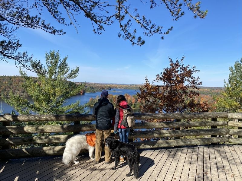
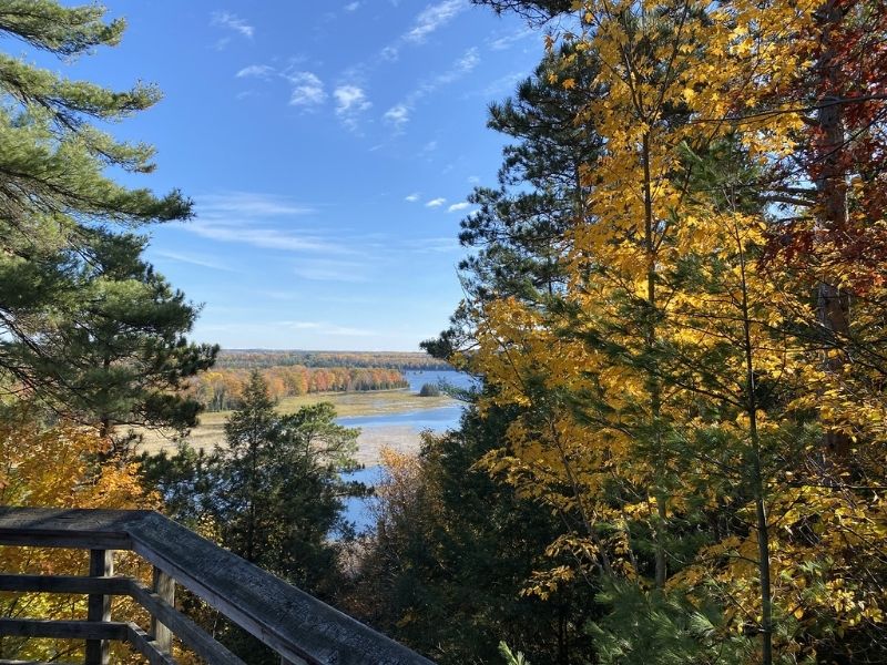
Observation Deck at Lumberman’s Monument
It is pretty easy to get to the Dune Trail Observation Deck overlook.
From the visitor center, follow signs for the Dune Trail on the east side of the parking lot.
You’ll find a 0.25-mile trail that’s mostly flat. The trail surface is made of crushed limestone and is intended for stroller/wheelchair use.
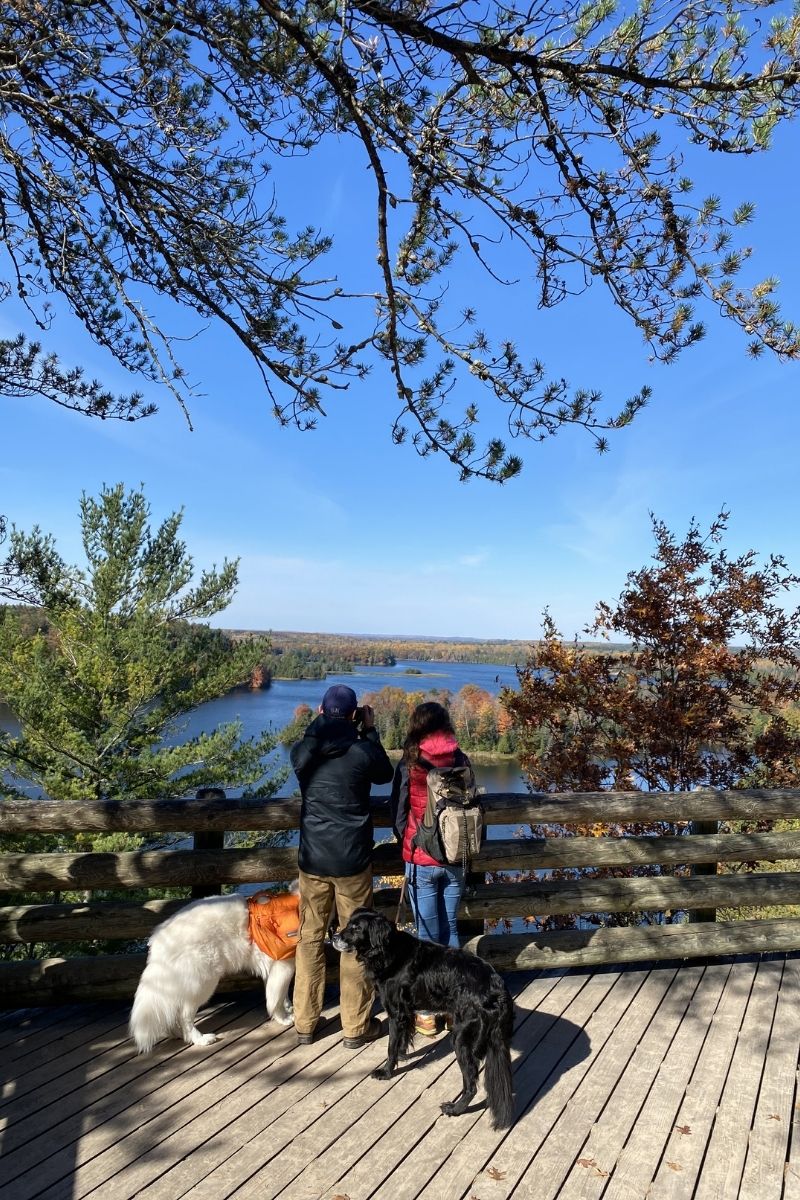
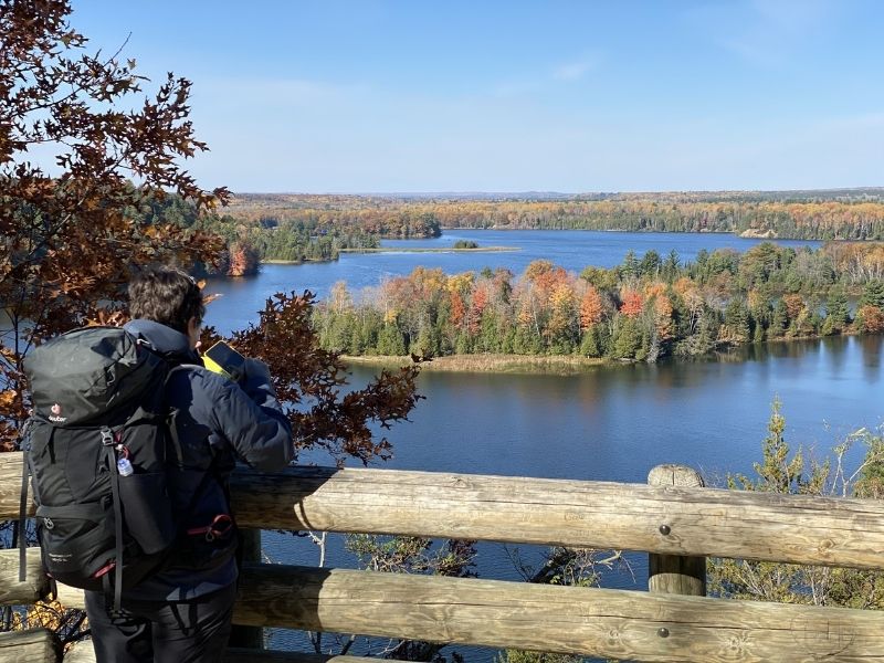
When you’re ready to head back, either take the same path or choose the short, 0.5-mile Forest Discovery Trail that is also suitable for strollers.
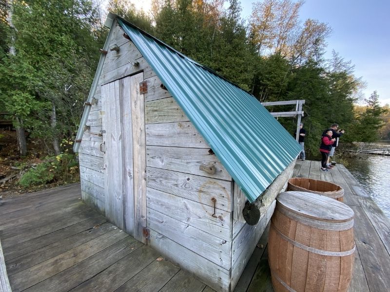
Visit the Floating Loggers Cookshack
If you’re willing to hike 260 steps down to the edge of the Au Sable River – and back up again – you can board the Wanigan.
The Wanigan is a replica of a logger’s floating cook shack that would accompany the lumbermen on their journey down the river.
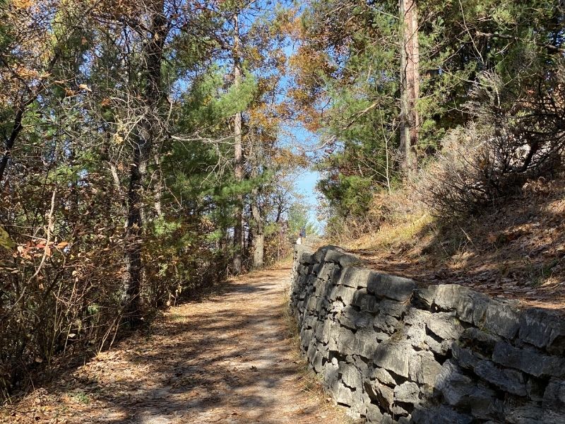
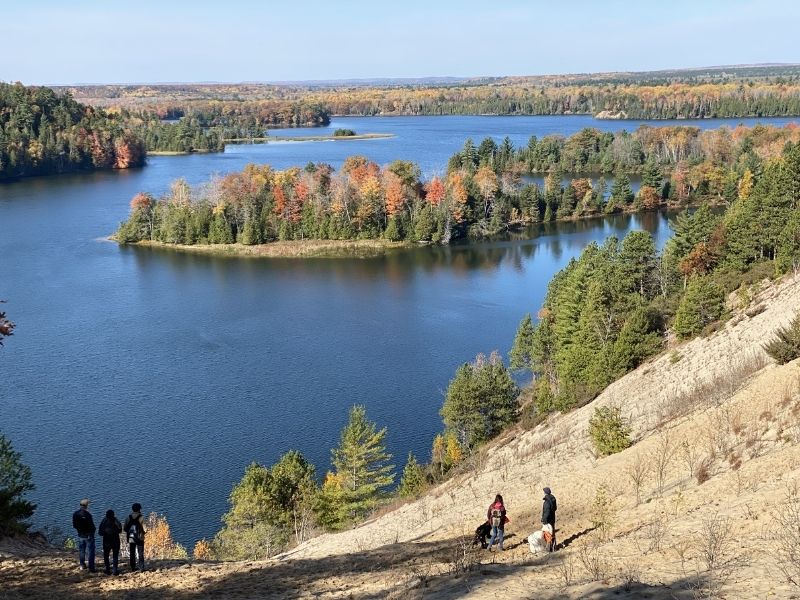
Dune Trail & Highbanks Hiking Trail
HIGH BANKS SAND DUNE
You can pick up the Highbanks Hiking Trail from the Visitor Center.
If you follow the Dune Trail and then keep heading east after the observation deck, you’ll quickly come to a sand dune overlook (one of many great Michigan sand dunes.)
This trail wows hikers with sweeping views of the Au Sable River, as well as big sand dune climb areas. In fact, the Highbanks Sand Dune at the Lumberman’s Monument towers almost 200 feet above the Au Sable River.
HEADING WEST ON THE HIGHBANKS TRAIL
Hikers starting at Highbanks trail and hiking west to Iargo Springs will have a 3.5-mile walk.
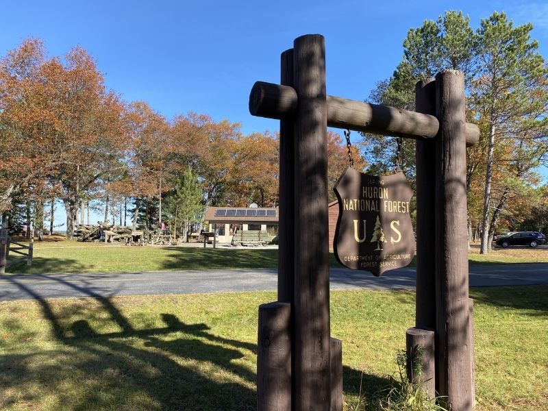
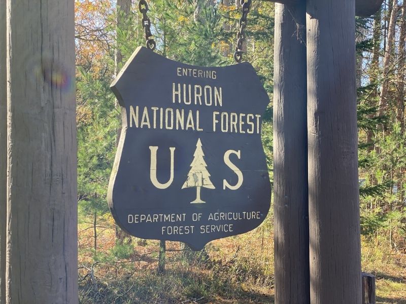
Huron National Forest & the Au Sable River
HURON NATIONAL FOREST
The Huron National Forest is located on the upper northeast side of Michigan’s Lower Peninsula and covers over 400,000 acres.
The US Forest Service manages the Huron National Forest in conjunction with the Manistee National Forest, calling the combo the Huron-Manistee National Forest. Apart from joint management, though, the two forests are separate entities.
The Huron National Forest is home to the Au Sable River and its counterpart, the River Road National Scenic Byway. It’s also where Lumberman’s Monument is located.
Au Sable River Road National Scenic Byway
Everyone should drive this 22-mile stretch of road in the Huron-Manistee National Forest.
And while you’re there, don’t skip the roadside turnoffs. You can’t see the river and its bluff views from the road.
It’s here, in the Au Sable River Valley, that you’ll find numerous active bald eagles nests, countless hiking, canoeing, and fishing opportunites, and show-stopper views.
AU SABLE RIVER
A 23-mile stretch of the Au Sable River was designated as a National Scenic River in 1984.
It’s one of five Wild and Scenic Rivers in Michigan.
From the USDA Forest Service website:
In pre-European settlement times, Native Americans used the river as a travel route.
After European settlement of the area, the Au Sable River was a major throughway for floating white pine to sawmills or waiting barges at ports on Lake Huron.
During those years many of the logs and fallen trees that littered the river were carried downstream with the harvested white pine.
In recent years efforts have been made to replace logs in the river to help reduce erosion and maintain the world-class trout fishing river as an aquatic habitat.
Rather, pull into one of the parking areas and you’re just steps away from breathtaking overlooks featuring the Au Sable River.
Aptly named the River Road National Scenic Byway, this drive follows the Au Sable River on its southern side.
Starting at the west end of the River Road, visitors will encounter:
- Westgate Welcome Center & Scenic Overlook
- Iargo Springs
- Canoer’s Memorial
- Lumberman’s Monument
- Foote Site Park & Au Sable River Queen
- Foote Village
- Whirlpool River Access
- Eagle Run Trail System
Hiking trails connect some of these stops, letting you dig into the experience on a deeper level if time allows. (This article is a fantastic refelction of a hiker’s experience in the Huron National Forest.)
Camping, fishing, and boating are also ways to enjoy the fall colors here.
Hale, Michigan is one of the nearest towns and a great place to stay if you’re looking for a home base for your explorations.
Westgate Welcome Center & Scenic Overlook
The Westgate Welcome Center is the western gateway to the River Road National Scenic Byway.
This is a great place to start your Byway adventure. Get maps, use the restroom (vault toilets), and enjoy the view of Loud Dam Pond. This stop is open year-round.
Use the info kiosk panel maps to explore the Byway route, features, trails, and visitor facilities before hopping back in the car.
Iargo Springs
Iargo Springs is the next stop on the River Road National Scenic Byway.
When you visit, you can either stay up on top of the bluff and admire the view of the river from an overlook or climb down 300 steps to reach the springs.
At the bottom of the stairs, there are several hundred feet of boardwalk paths to choose from in addition to seeing the springs.
Iargo is a Chippewa word for “many waters.” It’s believe that Native Americans would gather at the springs for tribal pow-wows and drink the water for it’s healing powers.

Two of the springs here have been dammed, creating small waterfalls. The other springs flow naturally into the Au Sable River.
Canoer’s Memorial
The next stop on the River Road is Canoer’s Memorial.
To understand the significance of this place we need to understand the backstory. Here goes:
Michigan is home to the AuSable River Canoe Marathon, an event that began in 1947 and is billed as “One of the Greatest Canoe Races on Earth!”
This event is epic and happens every July.
It’s a non-stop canoe race on the Au Sable River that starts at night. When the gun goes off, participants carry their canoes through the streets, running, all the way to the river where they jump in and start furiously paddling with 50,000 fans cheering them on.
The race starts in Grayling, MI, and ends 120 miles later in Oscoda, MI.
When you’re looking at the Canoer’s Memorial monument, you’re looking at a tribute that honors past race participants, including those who died while participating in the sport.
Looking around, you can also see Cooke Dam Pond from here.
Today, the U.S. Forest Service owns and manages the land where the monument sits. Oscoda Township has a special use permit to maintain the structure.
Footesite Park & The Au Sable River Queen Paddleboat
Foote Site Park (1775 E. River Rd. Oscoda, MI 48750) has the only swimming beach along the River Road Scenic Byway.
Foote Site Park is also where the Au Sable River Queen, the only paddlewheel riverboat operating in Northern Michigan, docks.
Reservations are made by calling 989-739-7351. They operate seasonally.
Whirlpool River Access
Whirpool River Access is accessible.
You don’t need a boat and you don’t need to climb down steep banks to get to the water.
Located at 5761 N. Skeel Ave., Oscoda, MI 48750
Eagle Run Trail System
E River Rd, Oscoda, MI 48750
At the eastern end of the Scenic Byway, the Eagle Run offers a loop trail system for hiking, mountain biking, and cross country skiing, with scenic views of the Au Sable River.
There are seven miles of trails here, covering flat terrain.
Trails are groomed in the winter for Fat Tire Biking.
When to Visit Huron National Forest for the Best Fall Colors?
October is the best month to visit Huron National Forest if you’re looking for vivid fall colors.
Color along the eastern shore of Lake Huron peaks slightly later than inland locations because the lake moderates temperatures, delaying the color change.
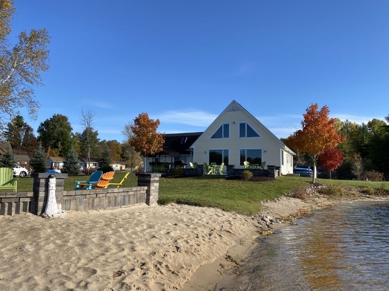
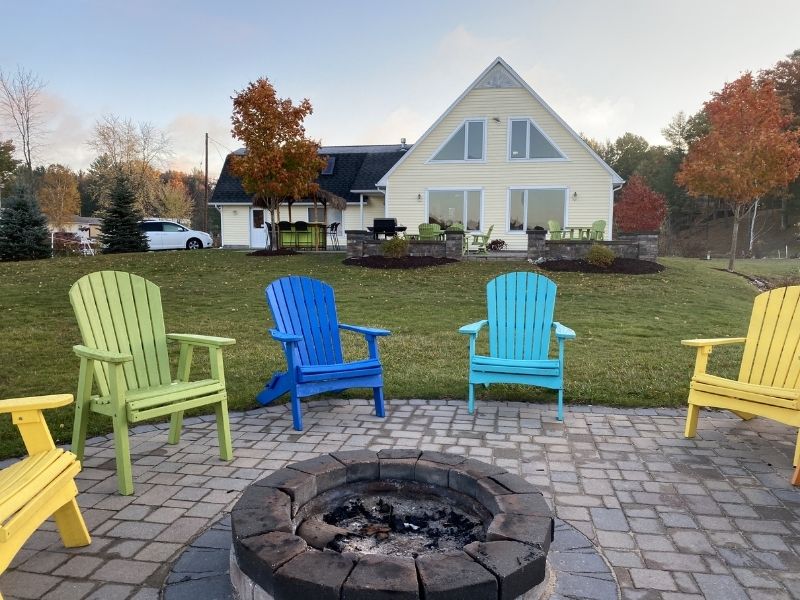
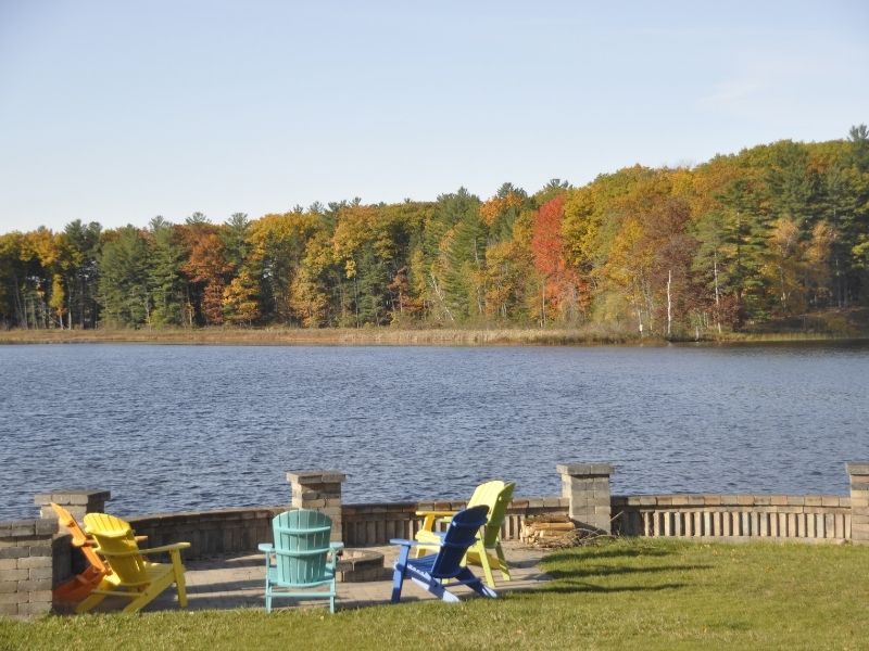
Where to Stay
Hale, Michigan, is a small town not far from the Scenic River Road and Au Sable River.
We stayed at this beach house when we were there and it had everything we needed.
(We also found out that the owners have a house on a private island in the middle of the lake and that looked pretty sweet.)
Here are links to these VRBO vacation rentals: